
Super Typhoon Rosal begins to weaken but warnings still in effect - Rappler
Already have Rappler+? Sign in to listen to groundbreaking journalism.
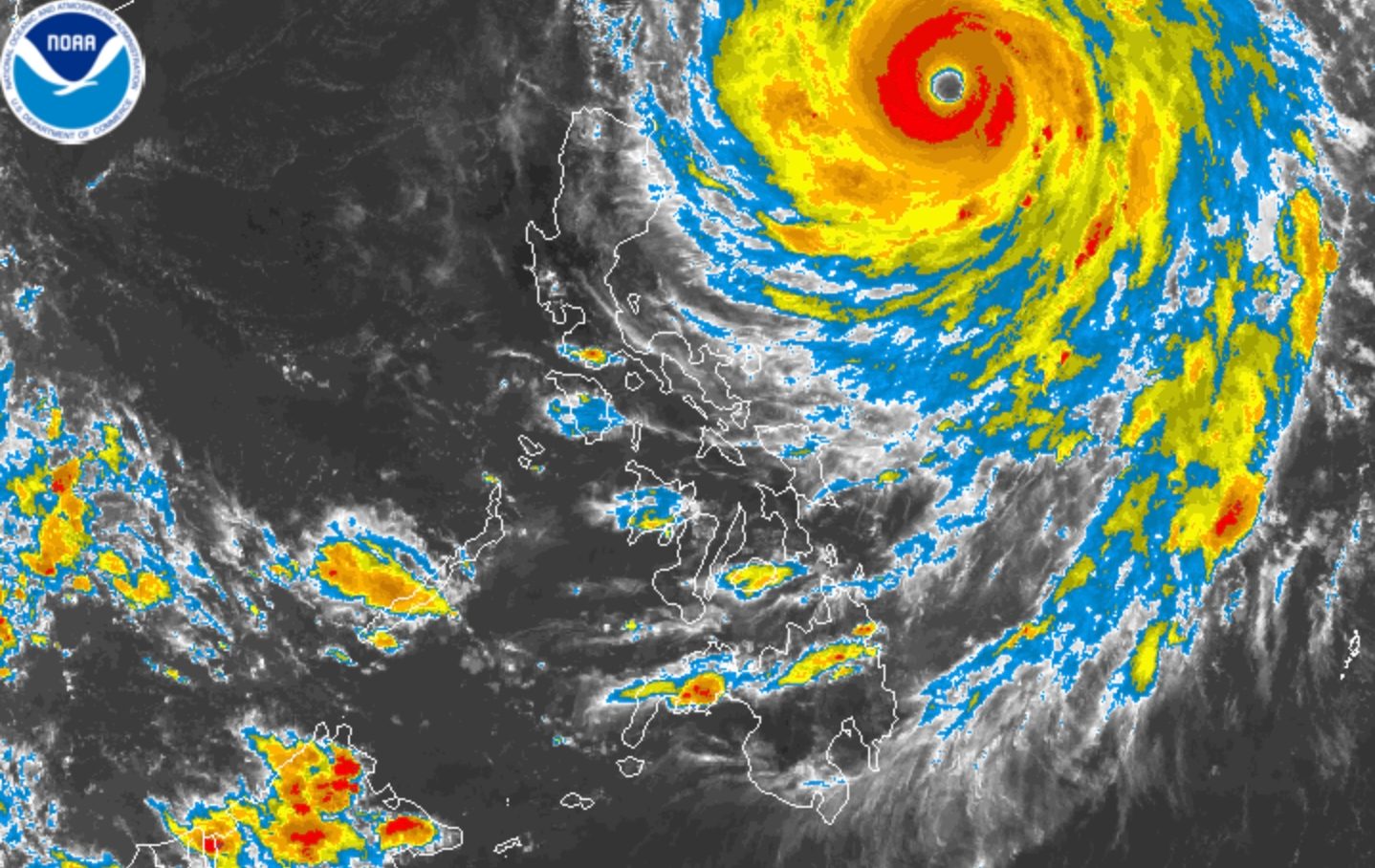
ROSAL. Satellite image of Super Typhoon Rosal (Champi) as of October 21, 2026, 4 pm.
This is AI-generated. Read the article for full context. Report any errors.
MANILA, Philippines – Super Typhoon Rosal (Champi) started to weaken on Wednesday afternoon, October 21, with its maximum sustained winds slightly easing to 205 kilometers per hour from a peak of 215 km/h.
The super typhoon’s gustiness also eased from 265 km/h to 250 km/h, said the Philippine Atmospheric, Geophysical, and Astronomical Services Administration (PAGASA) in its 5 pm bulletin on Wednesday.
PAGASA expects Rosal to be downgraded to a typhoon by Friday, October 23. Under the weather bureau’s classification, a typhoon has maximum sustained winds of 118 to 184 km/h.
Rosal was last spotted 725 kilometers east of Aparri, Cagayan, at 4 pm on Wednesday. It is still moving west northwest at 25 km/h and will continue to stay offshore.
However, Rosal will be closest to extreme Northern Luzon between Thursday afternoon, October 22, and Friday morning. Although landfall is not expected, it is still affecting portions of the country.
Aside from the provinces mentioned above, Ilocos Norte, Isabela, and Catanduanes are also likely to have rain with gusty winds from Rosal on Wednesday evening.
The rest of Cagayan Valley, the rest of the Cordillera Administrative Region, the rest of Bicol, Aurora, Northern Samar, and Eastern Samar may have scattered rain and thunderstorms as well, still due to the super typhoon.
PAGASA added that Rosal’s trough or extension might cause scattered rain and thunderstorms in the Negros Island Region, Antique, Iloilo, Guimaras, and Palawan.
There is a possibility of Signal No. 3 being raised, depending on Rosal’s track.
Conditions in many seaboards across the country remain dangerous, especially in Batanes, where waves can now go as high as 10 meters or nearly 33 feet.
Rosal could leave the Philippine Area of Responsibility by Friday evening or early Saturday morning, October 24. It entered PAR on Tuesday, October 20.
Rosal is the Philippines’ 18th tropical cyclone for 2026, and the first for October. PAGASA earlier estimated the country may have one or two tropical cyclones during the month.
The Philippines is currently in a transition period to the northeast monsoon or amihan, following the end of the southwest monsoon or habagat, which was announced last October 5.
The northeast monsoon typically brings surges of cold temperatures, but the upcoming amihan period could be warmer as the existing strong El Niño in the tropical Pacific Ocean is predicted to become very strong in the fourth quarter of 2026. – Rappler.com


